
12 March 2025
Key Takeaways:
- OffTrack employs photogrammetry for precise mapping of construction zones, including elevation profiles.
- The technology helps assess land area and calculate the volume of cut and fill, aiding in logistical planning.
- Below-water elevations may not be reliable; alternative methods like Bathymetric LiDAR or ROV sonar technology are available for underwater assessments.
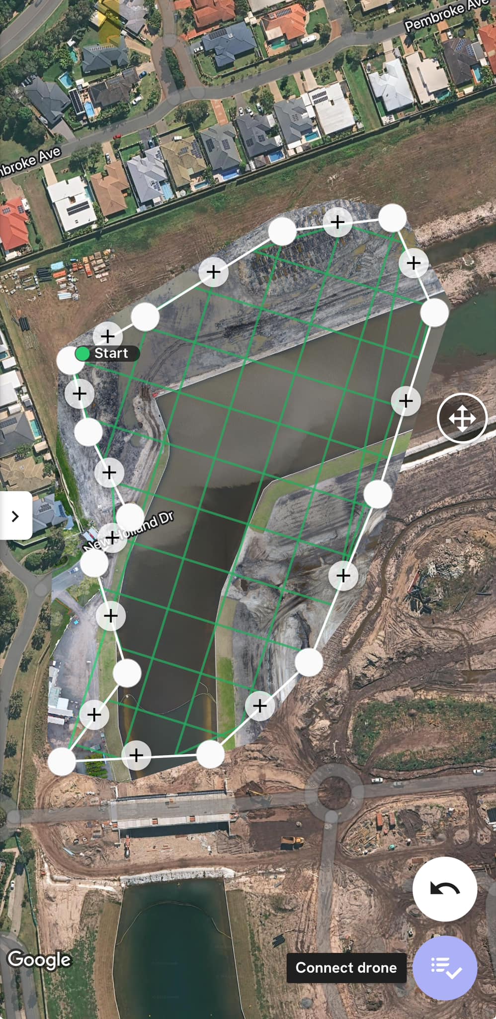
Revolutionary Mapping Technology
In a recent advancement in construction site analysis, the OffTrack Team utilizes photogrammetry to map construction zones effectively. This technology enables accurate measurements of land areas and provides detailed elevation profiles, crucial for project planning. According to OffTrack, it can assess the volume of cut and fill, helping teams estimate how many truckloads of material are needed for any given project.
While photogrammetry proves valuable for above-water mapping, the OffTrack Team notes a critical limitation—it lacks precision for below-water level elevations. The team suggests that for underwater depth profiling, more sophisticated technologies such as Bathymetric LiDAR or remotely operated vehicles equipped with sonar could be the preferred methods.
Images illustrating ongoing mapping efforts can be found below, showcasing the impressive capabilities of this technology in tracking construction project dynamics.
[More Images from the Mapping Efforts Below…]
[vid_embed]
