
04 September 2024
Key Takeaways
- The GIS Department of Finney County, Kansas, has invested in the AgEagle eBee X drone, featuring an Aeria X camera, to enhance its mapping efficiency.
- This drone is the first of its kind in the U.S. to operate over people and moving vehicles without requiring additional waivers, under FAA Part 107 regulations.
- With the capability to map vast areas—up to 1,235 acres in a single flight—the eBee X is set to revolutionize mapping efforts in the county.
- Tom Marchant, a GIS technician, highlights the drone’s impressive durability and low noise footprint, making it a practical choice for various applications.
- Key projects utilizing the eBee X include assessing road conditions, surveying parking lots, appraising large properties, and supporting new developments.
Finney County Enhances Mapping Capabilities with Cutting-Edge Drone Technology
In November 2023, the Geographic Information Systems (GIS) Department of Finney County, Kansas, celebrated a significant advancement in its mapping capabilities with the acquisition of the AgEagle eBee X drone, equipped with the sophisticated Aeria X camera. This new addition aims to address the county’s intricate geographical challenges while streamlining mapping efforts across its extensive 3,375 km² area.
According to reports, the eBee X is a unique asset in the U.S. drone landscape, as it operates under FAA Part 107 regulations and is the only drone permitted to fly over people (OOP) and moving vehicles (OOMV) without requiring waivers. This distinction allows the GIS Department greater operational flexibility compared to other models that necessitate additional permissions to fly in similar situations.
Mapping Large Areas with Unmatched Efficiency
“Our primary goal in acquiring the eBee X was to improve our ability to map large areas effectively,” shares Tom Marchant, a GIS technician at Finney County. With a population of around 37,650, the county faces significant mapping challenges that demand advanced technological solutions. The eBee X can cover an impressive 1,235 acres (500 hectares) in a single flight, a feature that supports the department’s ambitious project of mapping the entire city.
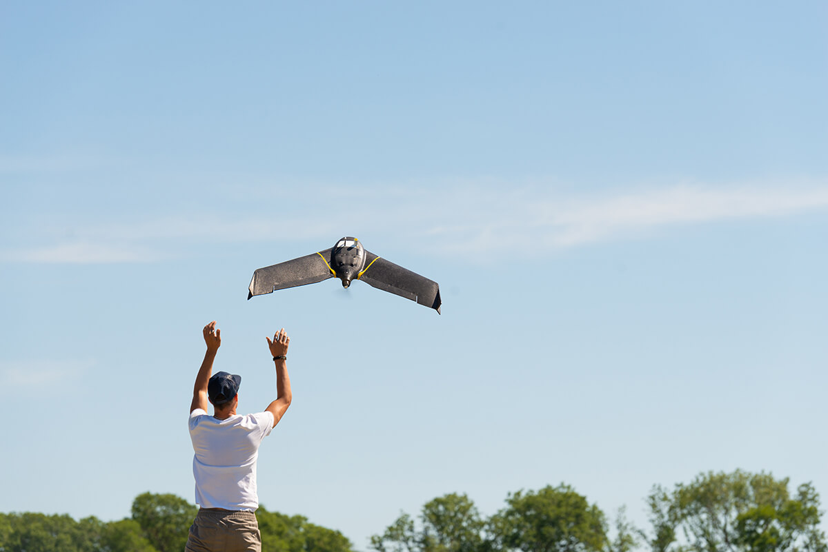
Among the various camera options for the eBee X, the department opted for the Aeria X, a 24 MP RGB camera, known for its precision in mapping. Marchant remarked, “The resolution and clarity of the images it captures are phenomenal.” Since conducting its inaugural flight in December 2023, the department has praised the eBee X for its durability, endurance, and ability to operate with minimal noise, seamlessly blending into the surroundings as it soars through the air.
Key Projects Utilizing the eBee X for Comprehensive City Mapping
The GIS Department serves a variety of county and city services, including public works, appraisals, communications, and utilities. The addition of the eBee X has led to the completion of several significant projects that underscore the drone’s versatility:
- Inspecting road corridors for public works to evaluate road conditions both before and after repairs.
- Surveying expansive parking lots to obtain precise measurements for repair cost assessments.
- Appraising properties situated on large tracts of land.
- Surveying new development zones for use by contractors.
Marchant elaborates, “With the eBee X, we can fly further, longer, and faster. This gives us the capacity to tackle the monumental project of mapping our entire city.” Estimates suggest that, under optimal wind conditions and lighting, the GIS Department could complete this city mapping initiative in just 14 days by maintaining visual line of sight and flying in quarter-mile sections. Upon completion, the project aims to provide substantial benefits for property appraisals, parcel mapping, and increased public access to high-quality maps.
Standard flight protocols involve operating at 365 feet above takeoff (ATO) with a 70% overlap in an interlaced flight pattern, achieving an impressive resolution of 0.90 inches (2.2 cm) per pixel. This meticulous approach ensures the highest quality and accuracy for mapping efforts.
