
19 July 2024
Key Takeaways
- Innovative Collaboration: In 2023, GeoAcuity partnered with Exposition Park in Los Angeles to enhance public safety through cutting-edge technology.
- Advanced 3D Modeling: Utilizing drone technology, the team successfully created a detailed 3D model of the park, which features major attractions.
- Drone Technology: The AgEagle eBee X drone was pivotal for its capability to map large areas and fly over populated regions without special waivers.
- Significance for Safety Training: The model generated serves as a crucial resource for public officials, aiding in safety training and risk assessment.
GeoAcuity’s Innovative Project for Enhanced Public Safety at Exposition Park
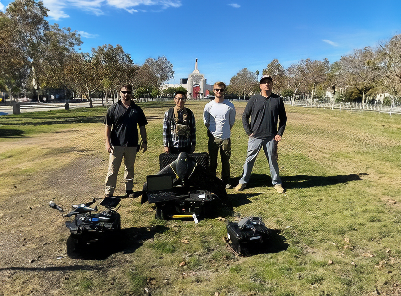
In an exciting collaboration that marks a significant stride in public safety training, GeoAcuity took on a groundbreaking project in 2023 at Exposition Park, Los Angeles. The primary objective of this initiative was to employ advanced drone technology to create a highly detailed 3D model of the park. This endeavor promises to enhance the way public officials are trained in safety protocols and assess potential risks within the complex.
A Bird’s Eye View of Exposition Park
Exposition Park, sprawling over an impressive 160 acres (approximately 65 hectares), hosts several renowned venues, including iconic stadiums and four world-class museums like the California Science Center. It is also home to the Space Shuttle Endeavor, making it a significant cultural and recreational hub in the United States. Given the park’s size and urban setting, the project involved extensive drone flyovers, raising the stakes as the team navigated the challenges of mapping an area in the nation’s second-most populous city.
The team utilized drones such as the eBee X to map Exposition Park in Los Angeles, United States.
Technological Marvels at Work
To achieve the ambitious goal of creating a detailed 3D model, GeoAcuity opted for the AgEagle eBee X drone. This drone is celebrated not just for its efficiency over large areas during flights that can last up to 90 minutes, but also for its FAA-approved capabilities to operate over populated regions without requiring additional waivers. Throughout the mapping process, the drone captured high-resolution imagery using the cutting-edge S.O.D.A 3D camera, ensuring that every detail of the park was meticulously documented.
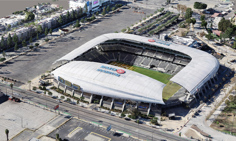
The 3D model created captured the BMO Stadium in Los Angeles, California.
Complementing the eBee X, the team employed two rotary-wing drones to enrich the data collected further, showcasing a multifaceted approach to aerial mapping that is becoming increasingly popular in public safety applications.
Creating a Digital Twin for Public Safety
By meticulously merging data from all three drones, including the eBee X, the team successfully produced a comprehensive 3D model of the entire park. This model achieves an impressive ground sample distance (GSD) of 1 inch (approximately 3 cm), resulting in a highly detailed representation of the area—often referred to as a “digital twin.”
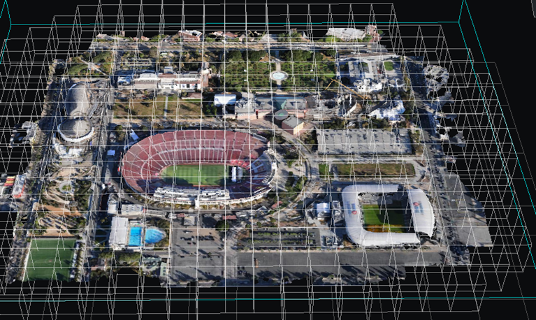
The comprehensive 3D model created using data from the eBee X now serves as a crucial tool for public safety officials.
This detailed dataset is poised to become an essential tool for public safety officials, enabling thorough vulnerability assessments and enriching safety training procedures, ultimately ensuring a safer environment for both visitors and residents.
As drone technology continues to evolve, the implications for public safety and urban planning are increasingly profound, with projects like GeoAcuity’s leading the charge towards more secure and better-managed public spaces.
